


Australian Earthquake Zones
Submitted by Robert Bast on November 29, 2012 – 9:32 pmNo Comment
Here’s the official map from Geoscience Australia. As is the case with any earthquake maps, it is purely backwards looking. Prior to the recent strong quake in Moe, Victoria, that part of map wouldn’t have been in red.
The Latrobe Valley town joined locations in the Northern Territory and Western Australia as the regions most at risk after Moe was at the epicentre of two earthquakes in as many months this year.
Shockwaves were felt by millions across the state, when a 5.4 magnitude quake – Victoria’s biggest – struck 16km southwest of Moe in June, damaging homes and throwing people from their chairs. [Source: Herald Sun]
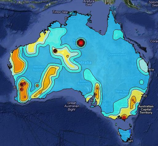
The full-size, interactive map can be seen here.


