Who were they created for?
Although some of the lines can be discerned from nearby hills, the majority can only be seen from the air, with some of them only visible from specific angles. Erich Von Däniken, who presumably did not consider any other possibilities, suggested that the figures were signals for spaceships, which would then land on the plain using the lines as runways. Taking time to discredit this theory (whereas most academics just laughed) Maria Reiche pointed out that the underlying ground is rather soft and the poor spacemen would have got stuck![9]
But why else would the etchings have been made so large, or even made at all?
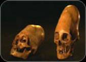
When studied under a microscope, some fabric from robbed Nazca tombs was found to be more finely woven than modern day parachute material. This gave an idea to a group from the International Explorers Society, who decided to construct a balloon made only from local vegetable fibres and reeds. The hot air was sourced from a simple fire pit. 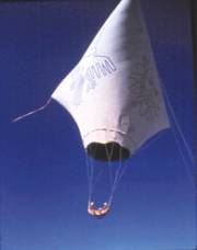
This “Condor I” was launched in November 1975 and took two balloonists to a height of 180 metres before a gust of wind returned them to the ground. After they jumped out, Condor I escaped and took off across the desert, rising to 350 metres, proving that it would have indeed been possible for the Nazca Indians to see the lines from above.[10] Jim Woodman (one of the balloonists) thought that the Nazca Indians could have used similar hot-air balloons for “ceremonial flights”.[11]
( More details on the Condor I )
Unfortunately, the air is not still above the Nazca lines, with the wind typically reaching 25 knots. A team from the University of Minnesota launched a balloon in June 1984, and on its very first flight it was wrecked by these strong winds – which implies that the ancient locals would have encountered similar problems.[12]
The Nazca Indians may have had their own uses for the lines. So might have an earlier culture, one that stealthily created them many millennia ago. Or could they have been left there for humans of a distant future, hoping to inform them of something very important?
What do they mean?
Almost everyone that studies this site comes up with a different idea. Some of these are:
- Astronomical alignments
- Weaving patterns
- Indicating subterranean water flow, found via rod dowsing
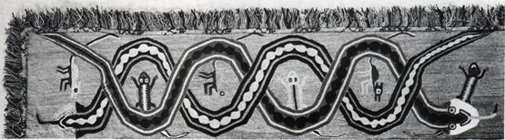
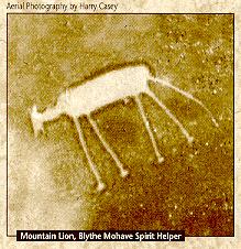
- Representations of gods, tribal clans or shamanic spirit animals
- A hieroglyphic writing system
- Work therapy
- Used as athletic tracks
- A map of somewhere (Lake Titicaca has been suggested)
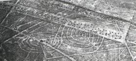
Another suggestion comes from art historian Alan Sawyer. “Most figures are composed of a single line that never crosses itself, perhaps the path of a ritual maze. If so, when the Nazcas walked the line, they could have felt they were absorbing the essence of whatever the drawing symbolized.”[13]
With the desert being so incredibly dry, water is obviously of great value to anyone living there. The ancient Nazcan inhabitants created a vast system of waterworks, consisting of wells 50 feet deep and 40-odd underground aqueducts, which cut across the Nazca River valley. Water was channelled from a handful of springs to provide drinking and water and irrigation for crops. Some of the aqueducts are several miles long and large enough for a person to crawl along. They are deep below the surface to protect the water from evaporation, with inspection wells every hundred metres to help the Indians clear away any debris. Despite their great age, many of these still function properly. One of the old aqueducts was even extended in 1955 to deliver more drinking water to the town of Nazca.[14]
Anthony Aveni (Professor of Astronomy and Anthropology at Colgate University) observed that “most of the line centers are located along the river banks, tributaries, and bases of the mountains from where the drainage proceeds.” The fact that large geometric shapes either point upstream (60%) or downstream (40%), adds weight to his argument that the lines are there to mark water tables.[15] But there is no connection between water and the animal figures. A proven, cohesive theory, covering all aspects of the lines and figures is yet to emerge.
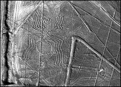
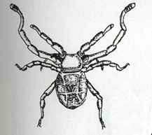
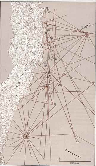
Maria Reiche was the first to suggest the astronomical theory. Certain lines could predict where important stars would rise, on special days. Figures like the spider and monkey might represent constellations, in a similar fashion to the Zodiac. Unfortunately, there are just too many lines. If there were a dozen or so, and most of them had an astronomical alignment, then the point would be proven. But there are 800 lines, of varying lengths and widths, each pointing in a different direction. By chance alone some must appear to have astronomical importance.
Professor Gerald Hawkins (author of Stonehenge Decoded) and his group went to Nazca to investigate the idea. Using special software, they checked star positions for the last 6900 years, and checked them against the lines. After weeks of study they concluded that there were alignments, but no more than could be attributed to chance. To illustrate this, Hawkins checked out Reiche’s claim that the Great Rectangle aligned with the Pleiades constellation in 610 AD. She was accurate. But if she had suggested alignment with the rise of Regulus in 410 AD, or the setting of Antares in 210 AD, she would also have been correct. Anthony Aveni obtained similar results in 1982. In addition, Reiche failed to explain why the lines had different lengths and widths.
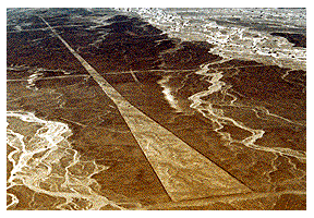
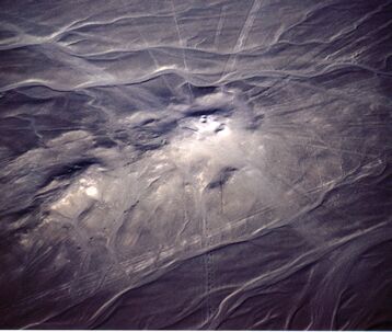
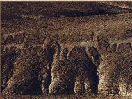
What did impress Hawkins was the straightness of the lines; on average they only deviate by two metres per kilometre, even over hills – as we see here, which von Daniken appropriately described as a ski jump.
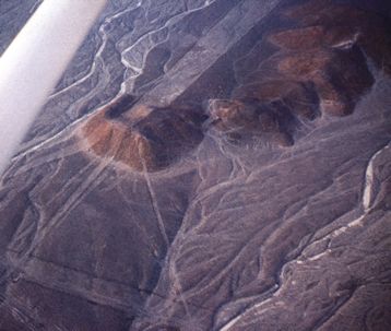
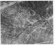
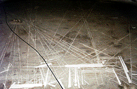
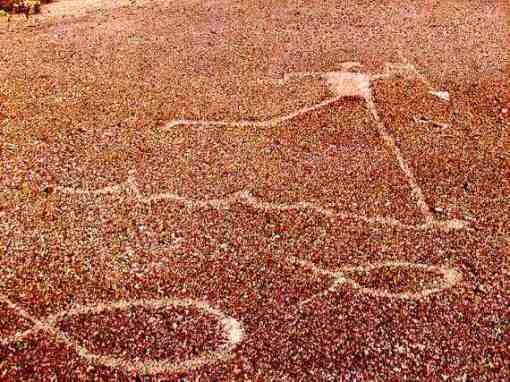
All except one of the lines radiate from common points, creating star-like patterns. Many of these “radiating centres” are actually small hills, perhaps fifty feet in height. This is hard to appreciate from the air, but if one observes them from ground level, they are obviously an important aspect of the layout.
Drowned Animals?
By looking at the lines from a catastrophic viewpoint, a partial solution can be arrived at.
This is one of the driest spots on the planet.[†] This means that primitive people were unlikely to live here, and if they did, unlikely to evolve into a technological culture, which would require the luxuries of free time and abundant essentials. This is therefore one of the last places you would expect humans to achieve flight. So perhaps the lines weren’t meant to be seen until we did manage to fly. This would ensure that they could remain undisturbed until a modern era, in which we would probably have the ability to decipher their meaning. Which is now.
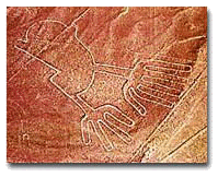
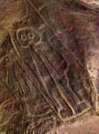
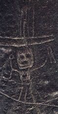
The drawings cover all the important genera – animal, bird, fish, insect and plant. The story being told here is not unlike that of Noah’s Ark from the Bible. Whereas Noah managed to rescue two of every species, the Nazca Plain shows us what happened to all the rest – they drowned. It shows how they have been swept together from diverse locations and dumped in one spot. They are flat, distorted and bent. Whoever designed the creatures had the ability to render them accurately, but they chose not to. Some call them stylised, I call them twisted.
There are no pairs[‡]. Single animals represent the end of the line. Pairs (like Adam and Eve) represent fertility and survival. “They” have created, ironically, a description of the greatest flood that ever was, upon one of the driest stretches of land on Earth. But what about the straight lines?
[9]McIntyre, Loren. 1975. :Mystery of the Ancient Nazca Lines.” National Geographic (May): 716-28.
[10] The Marshall Travel Atlas of Mysterious Places, Marshall Editions, 1977, p102
[11] Woodman, Jim. 1977. Nazca: Journey to the Sun. New York: Pocket Books.
[12] Evan Hadingham, Lines to the Mountain Gods: Nazca and the Mysteries of Peru, Random House 1987 ,page 43
[13]McIntyre, Loren. 1975. :Mystery of the Ancient Nazca Lines.” National Geographic (May): 716-28.
[14] Evan Hadingham, Lines to the Mountain Gods: Nazca and the Mysteries of Peru, Random House 1987 ,page 189
[15] Possibly from >The Lines of Nazca, ed. Anthony Aveni (American Philosophical Society, 1990) or Between the Lines
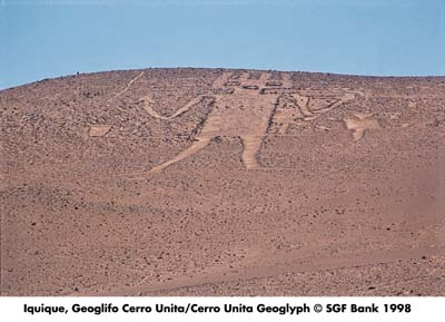
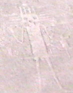
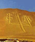 Just 130 miles from Nazca, dug into a sloping hill at Pisco Bay on the Peruvian coast, this drawing looks very much like a candlestick – which gives it the name of “The Candelabra of the Andes”. There has been much speculation about the purpose of the 595 foot high candelabra, but no definitive answer. It is constructed in a different manner to the Nazca lines, using trenches up to one metre in depth, and is best viewed from out at sea – it can be seen from as far away as 12 miles. Pottery found near the figure has been carbon dated to 200 BC.
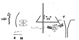

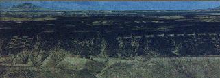
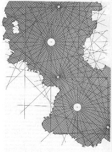 Or then again, perhaps the Nazca Lines are a terrestrial map. The image on the left shows the portolan design lines extracted from